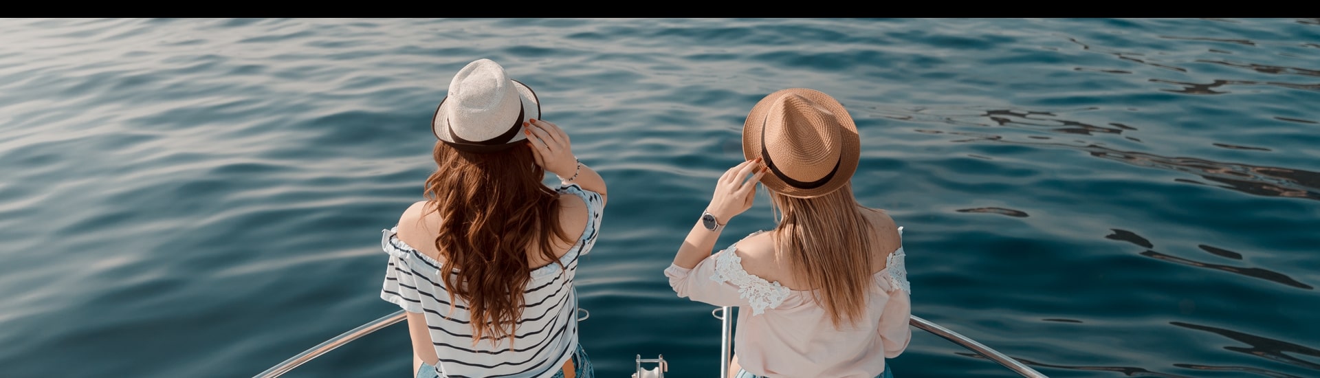
Sea Horizon
Top Destinations
Our Lady of the Rocks
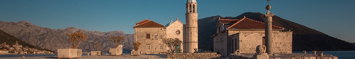
An artificial island of Our Lady of the Rocks with an interesting legend about the emergence. Peole say that on July 22, 1452, in the early morning mood, two Perast's fishermen noticed a strange light on a cliff that floated above the sea surface. As they approached, they saw the icon of the Our Lady with Christ. They took the icon to Perast and told a strange event. The citizens of Perast decided to build a small chapel dedicated to the Our Lady of the Rocks (scripio - scrigio - lat. Roccia, roccia, scrip). They have expended the island and have built a bigger church, and today's church is the third of its time and was built in 1630. The citizens of Perast widened the plate by throwing stones and plunging old ships damaged in the battles. In the deep sea of 12 to 20m they create a stable island area of 3030 m2. The calculations show that there are about 100 000 m3 of rock mass in the island, which speaks of a remarkable and persistent effort (about 200 years) of a small population. Every year, starting from 1452, to the present, on 22 July, citizens of Perast, with their boats in the traditional procession, named fašinada, dressed in national costumes, with the song carries stones and throws it around the island, which is a tourist attraction. In addition to the impressions provided by the island with its architecture, the church has been richly gifted for centuries and represents a sort of gallery and treasury of various objects. Beside the 68 oil paintings, the work of the most talented Baroque painter on the East Adriatic coast from the 17th century, Tripo Kokolja (1661-1713), is on the walls of the church. There are 2500 gold and silver votive plates that citizens of Boka Bay gifted to the church.
Blue Cave
.jpg)
The Blue Cave is a magical place of unusual natural beauty. It is a large cave, with an area of about 300 square meters. The height of the arches is twenty-five meters, and the depth is three to four meters. The Blue Cave has two entrances. It is named after the unusually blue color of the water, which is reflected on the walls of the cave due to the refraction of light, so they also seem "blue". Because of the lights, an effect was obtained, as if water were shining from the depths. The Blue Cave is very popular both among tourists and divers, because it is rich in various species of fish, octopuses, and the blue water gives it a special charm.
Perast
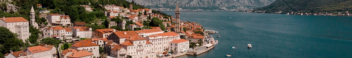
The beautiful town of Perast was named after the Illyrian tribe of Pirus. According to the legend, Queen Teuta wanted to secure the entrance to the bay, and she brought the tribe from Albania to settle the Eastern part of Risan.
Through history, many have sought to conquer Perast, starting with the Byzantine Empire, Venetian, French, and even Austrian invaders. Each of them, left a significant mark. Perast's greatest bloom was in the 17th and 18th centuries. The interior of the Boka Kotorska Bay was ruled by the Venetian Republic, and the outside belonged to the Ottoman Empire, so Perast had a remarkable strategic significance. Perast residents become privileged in the Republic of Venice, they had the right to trade on large ships and without tax to sell goods at the Venetian market, making them extremely rich. In turn, they defended the entrance to the inner part of the Boka bay.
From this period, the baroque palates of Bujović, Smekja, Zmajević families and the church of Our Lady of Rozarija with the Renaissance osmosis bell tower stand out. The most impressive is the palace Bujovic, which is a wonderful example of Renaissance-Baroque architecture. According to the legend owner Vicko Bujovic was very proud of her. And when the builder said that he could build better one, Bujovic threw him on the sea from the roof of the palate. Today, in this palate is the Museum of the City of Perast.
After the fall of the Venetian Republic and the Napoleonic Wars, Perast become under the Austro-Hungarian administration. Perast loses the defensive role, privileges and economic power and begins its 200 years long dying period. Almost all the buildings in Perast were built before the 19th century, in Baroque style, which gives it a special significance.
Although Perast had only 350 inhabitants, there were 18 churches and 19 palaces in it. The symbol of the city is the church of Saint Nicholas with its impressive 55 meter high bell tower, proudly above the building. Unfortunately, because of the lack of money, it was never finished.
Mamula
.jpg)
The Mamula Fortress, as well as the fortifications on Prevlaka and the Arza Fortress on Luštica, were all built by General Lazar Mamula in the middle of the nineteenth century. Their purpose was to protect the Bay of Kotor from the entry of the enemy into the territory of Austro-Hungary.
This island, is located at the very entrance to the Bay of Kotor, between the peninsulas of Prevlaka and Lustica. It used to be known as Lastavica, but later, after the builder of the fortress, it became known as Mamula.
The diameter of the fortress is two hundred meters, and the height is sixteen meters. During the First World War, the Austrians used the fortress as a prison, and during the Second World War, the Italian fascists turned the prison into a concentration camp. Now only the memorial plaque, which is located on the island, reminds of the prison.
Mamula is closed to the public today. Due to a plan to develop elite tourism, it has been leased to foreign investors, and the former torture camp will become a luxury resort with a hotel, nightclub, spa and restaurants.
Saint Georgie
.jpg)
In front of Perast there are two beautiful islands. One of them, Saint Georgie, with the eponymous Benedictine monastery from the 12th century, is a natural island. The largest part of the island occupies a cemetery where countless inhabitants of Perast and other towns of Boka are buried. The Benedictine priests have planted numerous cypresses, the symbols of death and disappearance, which emerged despite the belief that nothing can grow or prosper on the island due to salt water and a curse.
The island was inspiration of the famous Swiss painter Beklin for his famous image of "The Dead Island".
Verige
The narrowest part of the bay - Verige is about 300m wide. Verige divides the interior from the outer gulfs. On the left side of the Verige is the church Church of Our Lady of Angels. Although behind the door are written years 1654 and 1685, it is believed that the church is built earlier, and those years are years of big renovation.
In 1585. citizens of Perast have built up the walls with loopholes around the church, making this place strategically important fortress for the defense of their town. The church was destroyed in 1654 during an attack on the Turks in Perast, but was restored in the same year.
From this spot, if necessary, people have raised and stretched "verige", iron chains, to block the entrance to the inner bay of Boke. Because of this, name for this narrow is Verige - meaning chains
Old submarine tunnels
 (1).jpg)
Cut into the steep banks of the Luštica there are three tunnels. Although the tunnels were built during Yugoslavia, Luštica was an important military base during the First and Second World Wars as well as during the Cold War. The tunnels were used to hide and repair submarines and ships. The length of the tunnel is up to fifty meters, width 7 meters. The average depth of the tunnel is about eight meters, and the depth around the exit from the tunnel increases to thirty meters. Also in the submarine tunnel there is a whole complex of underground tunnels, in which there was technical equipment needed for servicing and repair of submarines.